

GIS Specialist | GIS Engineer | Data Management
- 3000 €
- Німеччина (Франкфурт на Майні)
- 19-09-2026
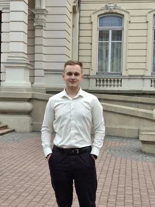
Контактна особа: Maksym Haina
Країна проживання: Україна
Вік: 24
Спеціальність: Дата-аналітик
Телефон:
Досвід роботи:
GIS Engineer / Network Data Management
Chernivtsioblenerho JSC
GIS Engineer specializing in geospatial data management and automation for power infrastructure networks. 3+ years of daily hands-on experience with GIS systems, spatial databases and Python-based automation tools.
Key responsibilities & achievements:
- Daily QGIS operation for digitising, editing and updating power infrastructure networks; working with satellite imagery and diverse spatial data sources
- Topology analysis, detection and correction of spatial errors in geodatabases; ensuring accuracy of technical documentation
- Developed PostGIS triggers for topology automation - FOCL line geometry dynamically updates following pole position changes via ID-binding in spatial database
- Spatial database management using PostgreSQL/PostGIS - queries, data integrity, schema maintenance and updates
- Built an event-driven Python automation system that monitors network folders in real time, triggers document parsing (Spire.Doc + Pandas) and syncs structured data to Google Sheets via API - fully eliminating manual checks
- Developed QField Sync Automation Tool (Python + Tkinter + PyQGIS) - automates synchronisation of field geospatial data between mobile surveyors and central server, reducing daily sync time from tens of minutes to a fully automated process
- Cross-departmental collaboration to maintain geospatial data accuracy across the company
- Head of PR Department, Youth Council of Chernivtsioblenerho JSC
Chernivtsioblenerho JSC
GIS Engineer specializing in geospatial data management and automation for power infrastructure networks. 3+ years of daily hands-on experience with GIS systems, spatial databases and Python-based automation tools.
Key responsibilities & achievements:
- Daily QGIS operation for digitising, editing and updating power infrastructure networks; working with satellite imagery and diverse spatial data sources
- Topology analysis, detection and correction of spatial errors in geodatabases; ensuring accuracy of technical documentation
- Developed PostGIS triggers for topology automation - FOCL line geometry dynamically updates following pole position changes via ID-binding in spatial database
- Spatial database management using PostgreSQL/PostGIS - queries, data integrity, schema maintenance and updates
- Built an event-driven Python automation system that monitors network folders in real time, triggers document parsing (Spire.Doc + Pandas) and syncs structured data to Google Sheets via API - fully eliminating manual checks
- Developed QField Sync Automation Tool (Python + Tkinter + PyQGIS) - automates synchronisation of field geospatial data between mobile surveyors and central server, reducing daily sync time from tens of minutes to a fully automated process
- Cross-departmental collaboration to maintain geospatial data accuracy across the company
- Head of PR Department, Youth Council of Chernivtsioblenerho JSC
Освіта:
Yuriy Fedkovych Chernivtsi National University
Master's degree
Field of Study: Hydrology and Water Resources Science
Dates: Sep 2023 – Jan 2025
Master's degree
Field of Study: Geodesy and Land Management
Dates: Sep 2023 – Jan 2025
Bachelor's degree
Field of Study: Geodesy and Land Management
Dates: Sep 2019 – Jun 2023
Master's degree
Field of Study: Hydrology and Water Resources Science
Dates: Sep 2023 – Jan 2025
Master's degree
Field of Study: Geodesy and Land Management
Dates: Sep 2023 – Jan 2025
Bachelor's degree
Field of Study: Geodesy and Land Management
Dates: Sep 2019 – Jun 2023
Професійні та інші навички:
Spatial Data Analysis
PostgreSQL
PostGIS
Extract, Transform, Load (ETL)
Remote Sensing
PyQGIS
Python (Programming Language)
ArcGIS Pro
Data Analysis
Analytical SkillsPostgreSQLPython
PostgreSQL
PostGIS
Extract, Transform, Load (ETL)
Remote Sensing
PyQGIS
Python (Programming Language)
ArcGIS Pro
Data Analysis
Analytical SkillsPostgreSQLPython
Додатково:
GIS Engineer & Geodesist with 3+ years of hands-on experience in geospatial data management, spatial database administration and Python-based automation. Currently working at Chernivtsioblenerho JSC, where I digitise and maintain power infrastructure networks using QGIS and PostgreSQL/PostGIS on a daily basis.
Beyond core GIS work, I build real automation tools that solve actual problems — from an event-driven document processing system integrated with Google Sheets, to a QField Sync desktop application that reduced field data synchronisation from tens of minutes to a fully automated workflow.
I hold two Master's degrees: Geodesy & Land Management and Hydrology — which gives me a strong theoretical foundation combined with practical engineering experience.
Core stack: QGIS · ArcGIS · PostgreSQL/PostGIS · Python · PyQGIS · QFieldSync · Pandas
What sets me apart is the ability to bridge classical geodesy with modern software development — I don't just work with GIS data, I build tools that make GIS workflows faster and more reliable.
Notable projects:
→ QField Sync Automation Tool — Python desktop app automating field survey data sync between mobile teams and central server (open source: github.com/makson2130/QField-Sync-Helper)
→ PostGIS topology triggers — automated FOCL line geometry updates linked to pole position changes via ID-binding
→ Event-driven document automation — real-time folder monitoring with automatic data extraction and Google Sheets integration
Based in Chernivtsi, Ukraine · Open to remote work and relocation within Europe
Beyond core GIS work, I build real automation tools that solve actual problems — from an event-driven document processing system integrated with Google Sheets, to a QField Sync desktop application that reduced field data synchronisation from tens of minutes to a fully automated workflow.
I hold two Master's degrees: Geodesy & Land Management and Hydrology — which gives me a strong theoretical foundation combined with practical engineering experience.
Core stack: QGIS · ArcGIS · PostgreSQL/PostGIS · Python · PyQGIS · QFieldSync · Pandas
What sets me apart is the ability to bridge classical geodesy with modern software development — I don't just work with GIS data, I build tools that make GIS workflows faster and more reliable.
Notable projects:
→ QField Sync Automation Tool — Python desktop app automating field survey data sync between mobile teams and central server (open source: github.com/makson2130/QField-Sync-Helper)
→ PostGIS topology triggers — automated FOCL line geometry updates linked to pole position changes via ID-binding
→ Event-driven document automation — real-time folder monitoring with automatic data extraction and Google Sheets integration
Based in Chernivtsi, Ukraine · Open to remote work and relocation within Europe